DRONE BASED VFX SERVICES FOR THE FILM INDUSTRY The DroneBoy Team are now offer a broad range of aerial VFX solutions and we are excited to make these services available to our film industry clients, VFX departments and virtual stage content creators. Drones and drone based sensor packages can accurately capture huge amounts of data in a very short period of time. Our aerial VFX solutions are cost effective, often safer than ground based options, incredibly accurate and highly efficient. We have been working in the film industry with our camera drones for over ten years now so our Team is “set savvy” and have the appropriate union affiliations where required (I.A.T.S.E. etc).
"The LIDAR of both the open field and Victoria College was perfect for what we needed. Locked in like a precision machine! "
VFX DRONE SERVICES:
Virtual 3D Mapping We can provide aerial LiDAR data combined with photogrammetrv to create detailed 3D models of sets and locations for use in virtual-stage productions. These scale accurate 3D models can be shared with all your departments in order to view, manipulate and accurately understand your set or location in the virtual world.
Aerial LiDAR Scanning LiDAR (Light Detection and Ranging) is an incredibly powerful tool that enables us to scan your set or large set pieces and provide your VFX Team with scale accurate point-cloud models quickly and efficiently. The detailed data we collect is vital for producing realistic visual effects, whether you’re reconstructing environments, generating terrain, or matching virtual cameras and lighting. With our LiDAR scanning services, you’ll have extensive information that brings extra depth and realism to your VFX projects.
Aerial Photogrametry & Orthomosiacs By taking hundreds and sometimes thousands of high resolution aerial photographs we can turn the real world into detailed orthomosiacs and very high resolution stitched images. Our photogrammetry services harness cutting-edge imaging technology to extract precise 3D data from photographs. Through this process, we create detailed, lifelike 3D models of real-world objects and environments that integrate effortlessly into your visual effects pipeline. From digital asset creation to virtual set extensions, our photogrammetry delivers the accuracy and realism your project demands.
Drone Based Multi Camera Arrays Our Team can fly stabilized camera arrays with our purpose built Ultra Heavy Lift Drones and custom camera rigs. Our Array services deliver customized solutions designed around your project’s unique needs. We create bespoke builds that align perfectly with your camera system and preferred field of view. Featuring cutting-edge stabilized arrays, our technology enables easy transitions between ground vehicles and drones for smooth, consistent capture in any setting. This versatility ensures high-quality, dynamic visuals that elevate your storytelling and streamline your production workflow.We can fly 3-5 full sized cine cameras and lenses capturing a very large field of view allowing your VFX Department to look in whichever direction they like during their post production process.
Data Post Production We can capture the data on set giving the raw files to your VFX Team for processing or we can assist with the stitching and processing. We can provide the data in any format your team requires.
SOME OF OUR RECENT VFX CREDITS
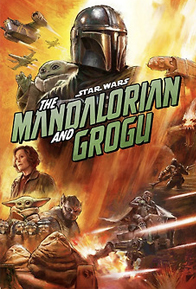
Mandalorian & Grogu
Frankenstein
bet
CONTACT US TODAY to find out how we can work together to assist you in your specific needs in the industry.